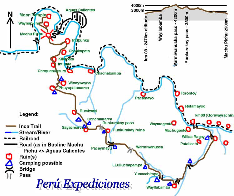
This map details the route of the famous Inca Trail leading to Machu Picchu. It shows the different stages of the trek, campsites, archaeological points of interest like Wiñay Wayna and Phuyupatamarca, and altitude variations. It’s essential for hikers, providing information on terrain difficulty, distances between key points, and the location of services. It also highlights the surrounding geography, including mountains, rivers, and cloud forests.
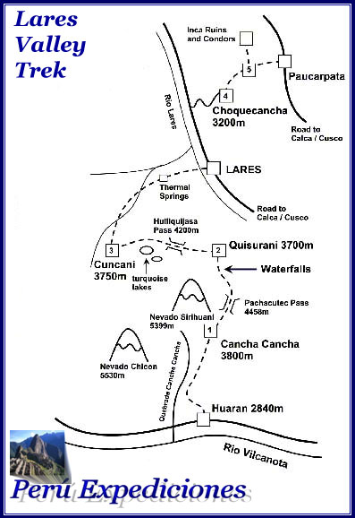
Lares Trek Map:
This map details the routes of the Lares Trek, a less crowded alternative to the Inca Trail. It shows traditional Andean villages, glacial lakes, snow-capped peaks, and mountain passes along the way. It includes information on altitude, campsites, and cultural points of interest, such as local markets and textile communities. It’s essential for hikers seeking a more authentic and less touristy experience.
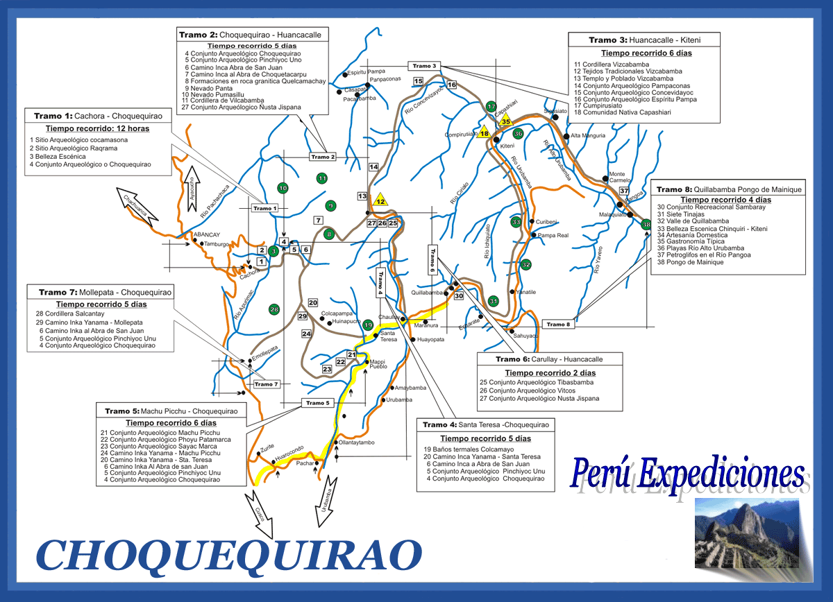
Choquequirao Map:
A Choquequirao map shows the location of this Inca citadel and the hiking trails to reach it. Due to its remote location, maps often include details about topography, terrain difficulty, and estimated hiking times. They also highlight the different sections of the archaeological site, such as terraces, temples, and plazas.
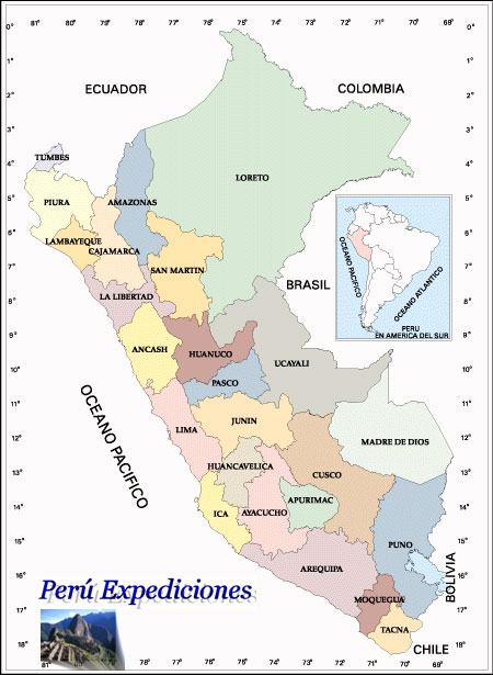
Map of Peru:
A map of Peru provides a comprehensive view of the country’s geography. It highlights the three main regions: the coast, the highlands, and the jungle, showcasing the diverse landscapes from coastal desert to Andean peaks and the dense Amazon rainforest. It includes information on major cities, rivers like the Amazon, lakes like Titicaca, and national parks. More detailed maps may show political divisions, roads, and the location of important archaeological sites.